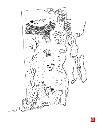
Rhode Island as a Fantasy Map
A downloadable map
The state of Rhode Island reimagined as a fantasy map. This map is part of the Integral States Project, an art series that encourages reflection about the actual, pre-colonial history of these landscapes as well as the indigenous peoples who called them home. Proceeds benefit native charities.
You’re very welcome to snag a free copy. Please rate if you like it to help others find these. Thanks!
Project website: https://integralstatesproject.com.
The Wampanoag, the Narragansett, and the Eastern Niantic peoples populated the area that is now Rhode Island. The Wampanoag have continuously inhabited their ancestral lands for ten thousand years. Today, the Wampanoag are organized into at least five different tribes. The Narragansett lived throughout present-day Rhode Island, Connecticut and eastern Massachusetts. The Narragansett built temporary shelters in the summer and moved into permanent shelters large enough to house twenty families during the winter. The Eastern Niantic (perhaps Nehantic, which means “point of land”), split off from the Western Niantic due to the migrations of the more numerous Pequots, allied with the Narragansett.
Download
Click download now to get access to the following files:

Leave a comment
Log in with itch.io to leave a comment.