Delaware as a fantasy map
A downloadable map
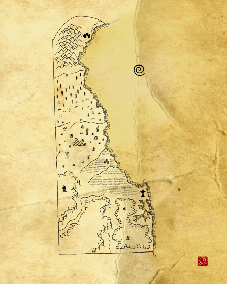
The state of Delaware reimagined as a fantasy map. This map is part of the Integral States Project, an art series that encourages reflection about the actual, pre-colonial history of these landscapes as well as the indigenous peoples who called them home. Proceeds benefit native charities.
You’re very welcome to snag a free copy. Please rate if you like it to help others find these. Thanks! Prints are available at: https://www.redbubble.com/people/aldayuan
Project website: https://integralstatesproject.com.
The peoples of present-day Delaware planted corn and beans for sustenance but also cultivated squash, pumpkins, sunflowers, and tobacco. The Nanitoke (or Nentego, which means “Tidewater People), are an Algonquian speaking tribe who traditionally lived in domed wigwams off the Chesapeake Bay. The Susquehannock used sturdy canoes and an extensive network of roads to travel throughout Susquehanna River Valley and tributaries of that river. Some members of the Lenape tribe trace their heritage back to the Susquehannock but the last members of the tribe were viciously murdered in 1763 by the Paxton Boys, who were also stealing native land in violation of treaties. The Lenape (“original person”) lived throughout the Northeastern Woodlands of the continent and were an Algonquian speaking people.
Download
Click download now to get access to the following files:


Leave a comment
Log in with itch.io to leave a comment.